


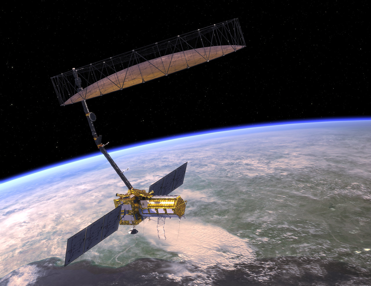
The NASA–ISRO Synthetic Aperture Radar (NISAR) satellite, set to launch on July 30, 2025, marks a historic joint mission worth about US $1.5 billion. It will be carried aboard ISRO’s GSLV-F16 from Sriharikota into a polar, sun‑synchronous orbit 747 km above Earth.
Equipped with two radar systems—L‑band from NASA and S‑band from ISRO—NISAR will scan nearly all land and ice regions every 12 days, with an average revisit time of 6 days. Its centimeter-level resolution works day or night, regardless of weather or clouds. NISAR aims to monitor key Earth processes: rising sea levels, melting ice sheets, ground shifts from quakes or landslides, forest changes, and groundwater trends. Data will be free and available within two days, helping scientists, planners, and disaster teams worldwide.
The mission is planned for three years, with a possible extension to five if fuel permits. It also reflects deep cooperation between NASA and ISRO combining radar tech, launch systems, and joint data use under shared goals.
By tracking millimeter-scale shifts, NISAR’s insights will enhance our understanding of climate change, natural hazards, and sustainable resource management all while deepening science collaboration between India and the US.


Post a comment


Why is ISRO building a new rocket launch pad?
ISRO is setting up a new rocket launch site in Tamil Nadu. But why now,...
Can deep ocean water really cool the world’s data centres?
IIT Bombay researchers propose deep seawater cooling for data centres, promising up to 79% energy...
Can U.S. Robot Cargo Planes change the balance in Indo-Pacific?
America is betting on cheap autonomous cargo planes to counter China. Could this shift the...
Killer specs, Killer price’: Redmi targets budget buyers!
Xiaomi unveils Redmi Note 14 SE 5G in India at ₹14,999, with AMOLED display, 50 ...


